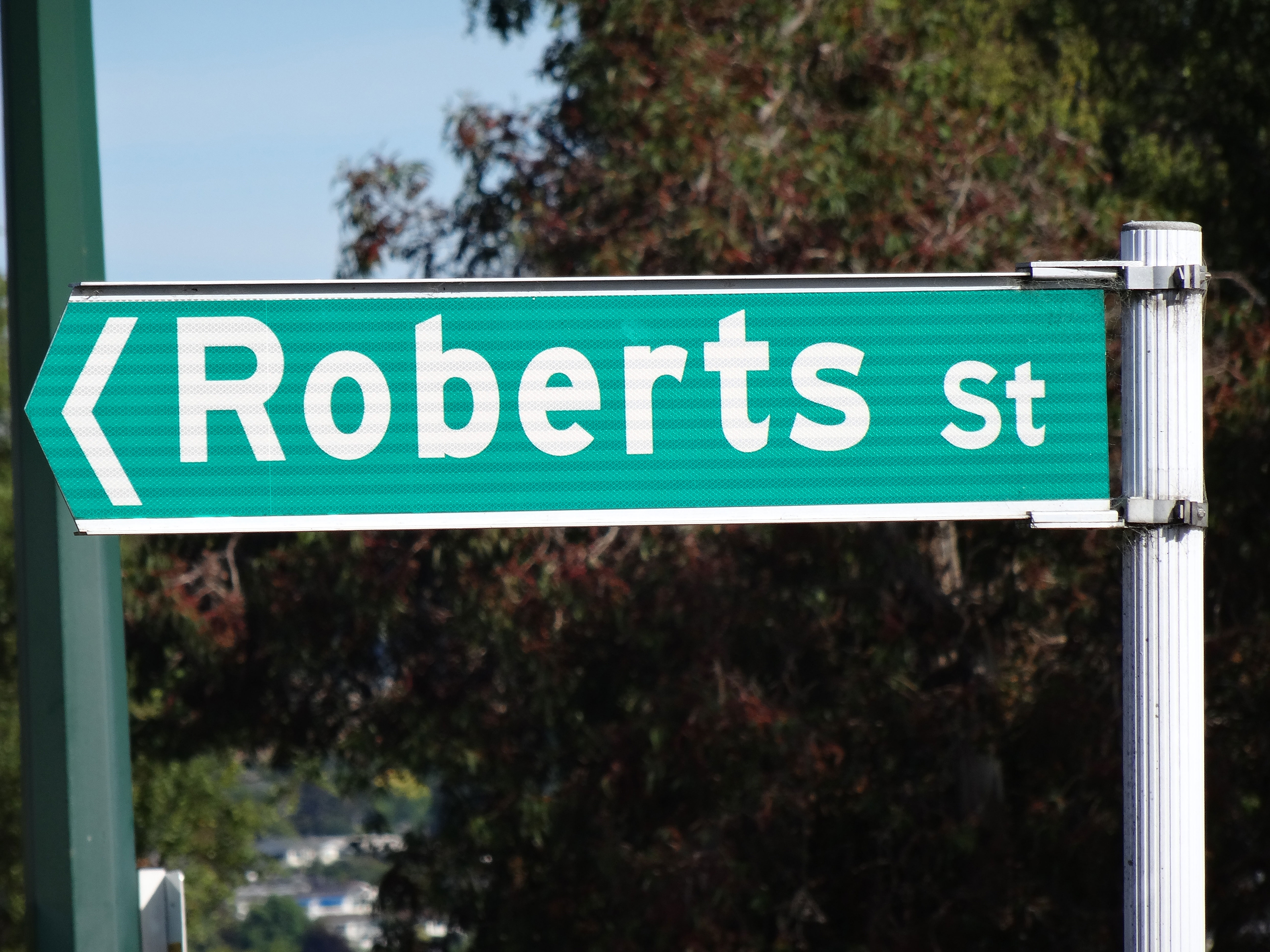
Cashel Street, Bealey Avenue, Lincoln Road. We give streets different labels based on their attributes. Streets tend to be narrower with more activity on them, Avenues tend to be wide and tree-lined, Roads are usually more focused on the through-movement function. Crescents are crescent shaped, Places are dead-ends.
If anyone had ever asked me to guess, I would have said we have maybe a dozen or so of these types of labels. But I would have been so wrong. I was perusing the Waimakariri Engineering Code of Practice when I stumbled upon this table.
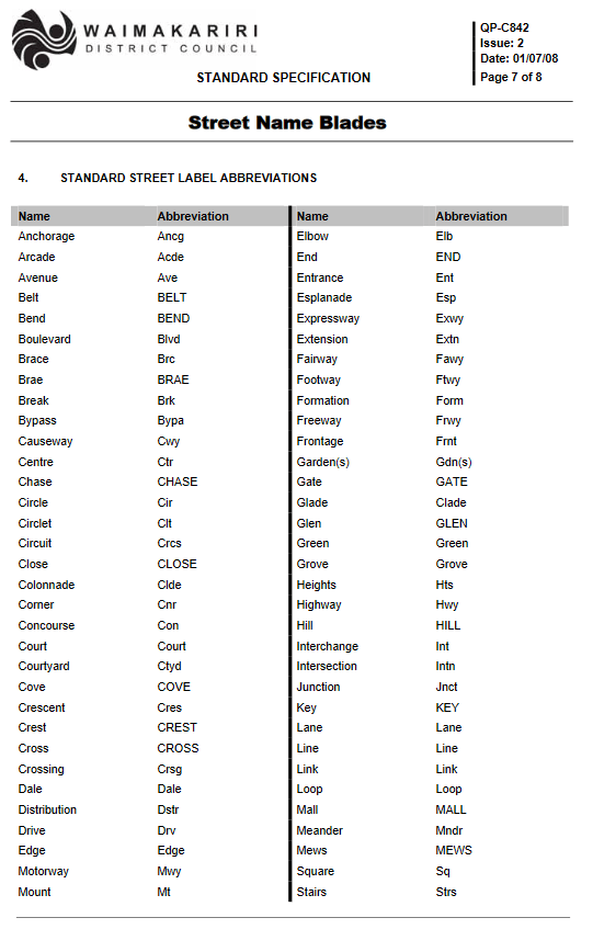
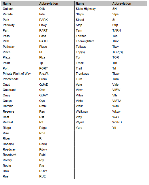
I was blown away how many labels are on this table. 121 to be exact. They couldn’t even fit them all on one page. Probably about a quarter of them I think I have seen used somewhere on a street but most I haven’t – “Anchorage”, “Brace”, “Brae”, “Circle”, for instance.
I’d be a big fan of seeing more of these being used in new subdivisions, rather than just calling everything “street” as this the usual practice. I feel like this would give a bit more variety and liven things up a little. I’d certainly pay more to live in Cashel Elbow than boring old Cashel Street.
How many of these have you come across in real life?

I did an analysis of Christchurch street names a few years ago. Out of 4000+ streets there were 58 different typonyms used, including a few not on Waimak’s list. 23 of these were only used once though, and the top 5 (Street, Place, Road, Lane, & Avenue) were used for 81% of names, so definitely room for more variety.
LikeLike
Wow thats a good effort. Id love to see the analysis if you still have it.
LikeLike
The less common ones seem to be far more common the older a city is. I recognise a lot of these, but only from my time in London and surrounds.
Some interesting New Zealand ones:
Waterloo Quadrant https://goo.gl/maps/Xr1Sa42uHAzvkVd6A
Bullock Track https://goo.gl/maps/w7f8qX916S6JvwEB6
The Strand (really common in harbour cities) https://goo.gl/maps/tFSBztjsSumoUoMv5
A whole lot of terraces and Quays in Lyttelton https://goo.gl/maps/cGVw4gGdHgp7k6EX9
Leithbank https://goo.gl/maps/xtVKnK3XUdvDWmRS9
Highgate https://goo.gl/maps/mDdh1n4dGEKsCNxZ7
Princes Wharf https://goo.gl/maps/PwtpPJepwhGrcHBi8
LikeLike
Yea the history of the town probably has a lot to do with it. Even that Bullock track one – I assumed that would be out in the countryside somewhere but it’s inner-city Auckland – must have been named a long time ago!
LikeLike