I wrote previously about Christchurch and Wellington populations. This is a follow up post with maps showing exactly where the growth occurred in both cities between 2013 and 2018.


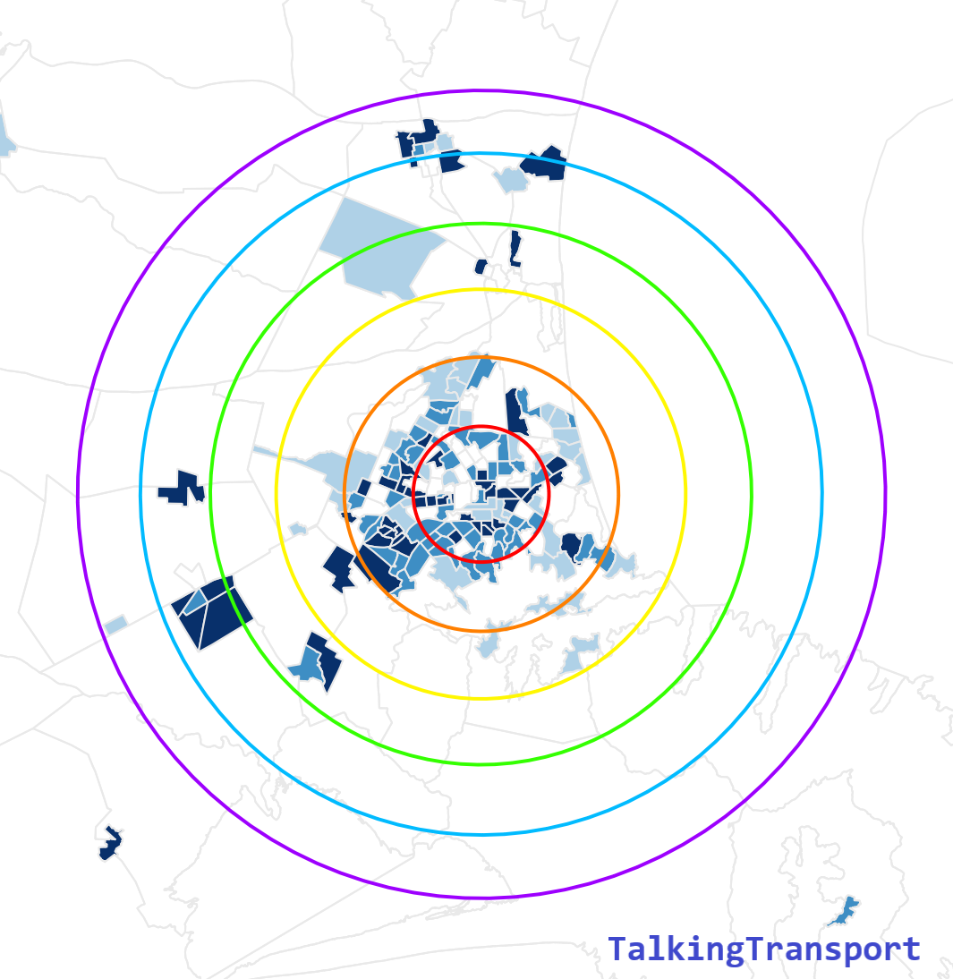
The concentric circles are 5km apart. The dark blue zones show where growth of over 200 people per square kilometre occurred, white zones are less than 10 people per square kilometre, and the various other shades of blue sit in between these.
The maps show that Christchurch has a lot of growth close in (<10km from the city centre) and smaller pockets of growth between 10 and 30km away (Rolleston, West Melton, Rangiora, Kaiapoi, Lincoln).
In contrast, Wellington has more distributed growth with relatively even growth in all bands out to 30km, and even beyond 30km. There are areas off the edge of these maps that still had significant growth; up the Kapiti Coast, over to the Wairarapa and as far away as Palmerston North. Here’s another zoomed out map of growth in the wider Wellington region.

Christchurch doesn’t have anything like this. If you zoom out on Christchurch’s map, there’s virtually nothing until you reach Timaru 150km away, with the exception of a small blip at Ashburton some 80km away.
So growth patterns in the two cities are quite different. Christchurch’s is occurring closer in than Wellington’s. This isn’t new – Christchurch has always been a city clustered around it’s centre, while Wellington has always been a city forced by topographical constraints to stretch up the valleys and coasts.
This has an impact on transport in the two cities. Average commute lengths in Christchurch are significantly shorter than in Wellington. You could argue that these population distributions make Wellington more suitable for commuter rail and long motorways, and Christchurch more suitable for walking, cycling, micromobility (e-scooters), light rail or streetcars.

Interesting observations. Here’s another perspective: Wellington city (not the wider metro area) shares many transportation attributes to Christchurch city (again, not the wider metro area) as you describe it, just on a smaller scale relative to its overall population. On the flip side, Christchurch’s wider metro area still stretches north-south 50-60km, with high growth centres at Rangiora and Rolleston respectively, albeit at a different split relative to Wellington and its own satellite centres
So this suggests to me that population growth distribution doesn’t necessarily dictate what each city is more suited to in terms of transport mode, but rather guides how different modes are implemented. I think this has been observed most prominently in Auckland over the last 10-20 years which, like Christchurch, has developed more concentrically compared to Wellington (just 40 – odd years ahead of Christchurch in terms of growth).
LikeLike
So are you saying that both cities need short-distance solutions close in (active transport, local buses etc) and long-distance solutions further out (commuter rail, etc)? I still think the numbers matter – the split of people living closer/further than 10km of the city centre is something like 80/20 for Christchurch but only 50/50 for Wellington.
LikeLike
Yes that’s what I’m saying. The numbers do matter, of course, but I think the impact is more nuanced than that. As I said, Auckland isn’t like Wellington at all, has developed commuter rail, but in a very different way as a result of those differences.
Like Auckland, I doubt Christchurch will remain at an 80/20 split for long as it wasn’t so long ago it was 90/10. However, unlike Wellington it will develop more concentrically. And Wellington, of course, has an evenly distributed core that will suit different solutions, just over a smaller area relative to Christchurch or Auckland.
LikeLiked by 1 person