Just a quick note to say that there is new guidance emerging around how to design our streets.
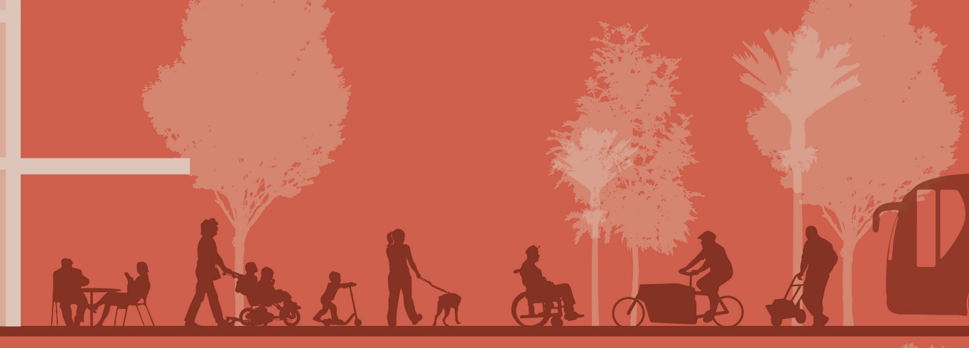
In the recent past our guidance has tended to focus mostly on how to design roads to be efficient conduits of movement. This new guidance coming out has a much broader focus, thinking about everything else that happens in our streets – kids playing, neighbours chatting, shoppers meandering, al fresco dining. It looks at how we can build streets that are nice places to be, rather than just efficient conduits for movement.
One Network Framework
Firstly there’s a new framework to classify streets (the somewhat boringly named One Network Framework). Up till now cities have tended to classify streets in a hierarchy of something like State Highway > Arterial Road > Collector Road > Local Street. This classification was based solely on how motorists move along these roads and the designs tended to follow this philosophy.
A new national classification scheme has come out which firstly, expands the idea of “movement” to encompass all modes: people on buses, bikes and foot, as well as cars. And secondly it introduces a “place” function, which takes into account all the other things that happen on streets.
The end result is a matrix of different street types (there’s also a separate version for rural areas but I’ll ignore that for now).
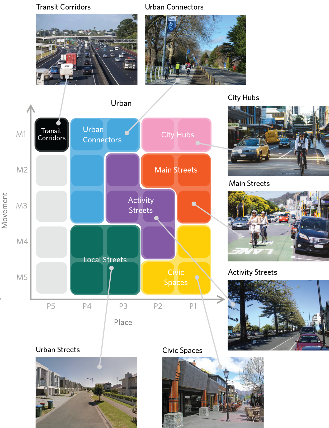
The top left has a high “movement” function but low “place” function – that’s motorways, busways etc.
The bottom right is high “place” function but low “movement” function – that’s pedestrianised areas, shopping streets, waterfronts, and the like.
Then you have a whole range of streets in between those two extremes.
Aotearoa Urban Street Planning and Design Guide
The practical application of the One Network Framework is outlined in the recently released draft of another boringly named document, the Aotearoa Urban Street Planning and Design Guide.
This starts delving into some conceptual designs of what best practice designs for some of these sorts of streets should look like. It’s a massive document but I’ve just pulled out a few images I thought were interesting, particularly in the Christchurch context.
Christchurch has thousands of suburban residential streets: this is the concept recommended in the guidance:
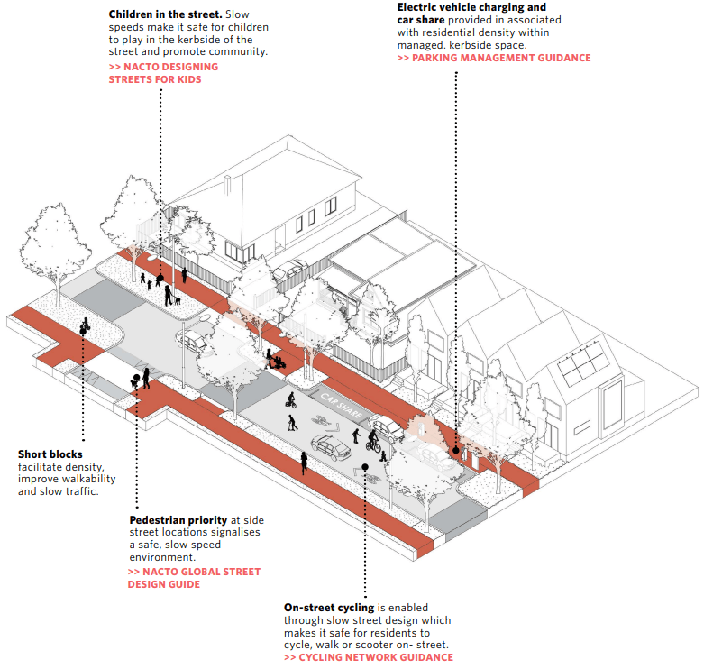
Personally I’d love to raise my kids on a street like this – it would be safe enough for them to walk to school independently (which our current street isn’t). It wouldn’t take much to shift many of our current streets towards something more family-friendly like this.
The busier Connector Streets get this treatment:
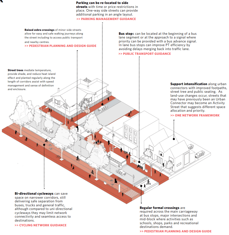
Again, the first thing is making sure people can get around safely on foot and bike, but vehicles do get more priority on this type of street (only moving vehicles though – it recommends shunting parking off to the sideroads).
The busier and more built up streets look like this:

Lots of Christchurch’s newer central city streets look like this – Colombo Street springs to mind with its 30km/h speed limit, decent footpaths and cycleways on both sides, 2 quite narrow traffic lanes in the middle, intermittent bus priority, and pedestrian laneways.
There’s lots else in the document that I won’t go into here – have a look yourself if you’re interested.
A lot of it is stuff that councils around the country have been doing to some degree, but it’s been quite ad hoc and not so explicitly supported by the Transport Agency. I think it could be quite a change now that the national Transport Agency (who co-fund all these streets) have officially said that these designs are their preference – you can expect to see these sorts of designs rolled out a lot more in coming years.
